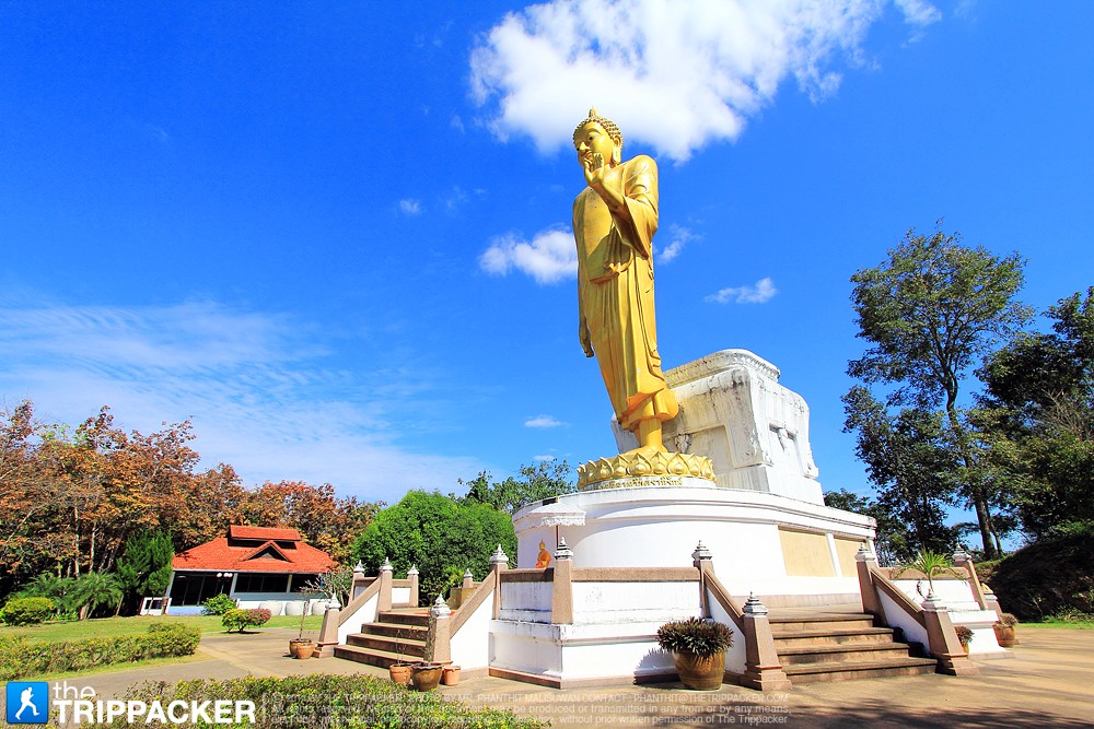
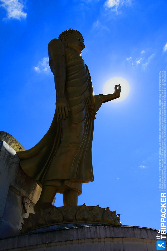
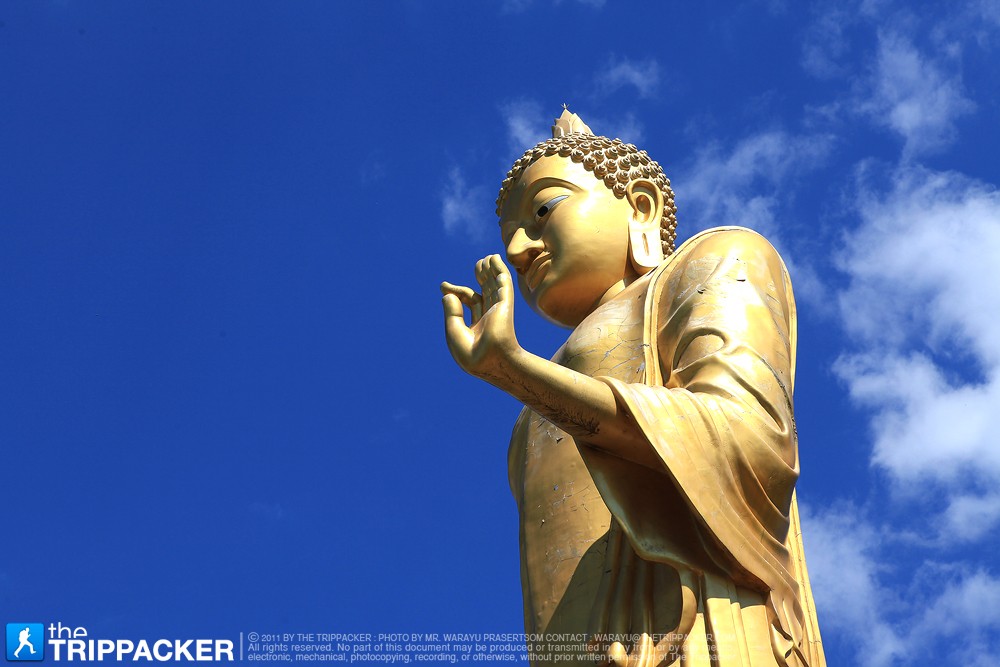
พระพุทธนวมินทรมงคลลีลาทวินคราภิรักษ์ หรือที่ชาวบ้านเรียกกันติดปากว่า “พระใหญ่ภูคกงิ้ว” แห่งวัดปากน้ำเหือง เป็นพระพุทธรูปปางลีลาประทานพร สีเหลืองทองอร่าม หล่อด้วยไฟเบอร์ผสมกับเรซิ่น องค์พระมีความสูง 19 เมตร และมีฐานกว้าง 7.2 เมตร จัดสร้างโดยกองทัพภาคที่ 2 และประชาชน ถวายเป็นพระราชกุศลแด่พระบาทสมเด็จพระเจ้าอยู่หัว และสมเด็จพระบรมราชินีนาถ เนื่องในวโรกาสที่พระบาทสมเด็จพระเจ้าอยู่หัว เจริญพระชนมพรรษาครบ 6 รอบ และในมหามงคลแห่งพระราชพิธีราชาภิเษกสมรส ครบ 50 ปี เพื่อแสดงออกถึงความจงรักภักดี และสำนึกในพระมหากรุณาธิคุณอันใหญ่หลวงที่ทรงมีแก่พสกนิกรในพื้นที่ภาคตะวัน ออกเฉียงเหนือ โดยได้อัญเชิญปฐวีธาตุอันศักดิ์สิทธิ์ จากพระธาตุพนม พระธาตุเชิงชุม พระธาตุบังพวน พระธาตุขามแก่น พระธาตุนาคูน และพระธาตุศรีสองรัก มาบรรจุไว้ใต้ฐานองค์พระพุทธรูป รวมทั้งได้รับพระราชทานพระมหากรุณาธิคุณจากพระบาทสมเด็จพระเจ้าอยู่หัว และสมเด็จพระนางเจ้าฯ พระบรมราชินีนาถ พระราชทานพระบรมสารีริกธาตุมาบรรจุไว้ในพระเกศขององค์พระพุทธรูปด้วย ส่วนชื่อ “พระพุทธนวมินทรมงคลลีลาทวินคราภิรักษ์” นี้ สมเด็จพระญาณสังวรสมเด็จพระสังฆราชสกลมหาสังฆปริณายก เป็นผู้ประทานนามให้ ซึ่งมีความหมายว่า พระพุทธรูปปางลีลาประทานพรที่สร้างขึ้นเพื่อความเป็นสิริมงคลในรัชสมัย รัชกาลที่ 9